NOSTALGEO
INFORMATION GATHERING & VISUALIZATION
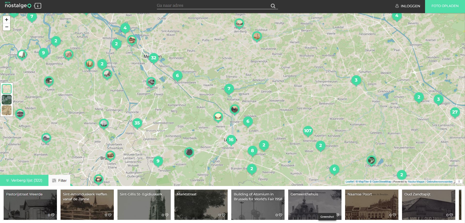
NOSTALGEO allows people to view old photos combined with today’s Street View. Users can also add and manage their own photos for free using the upload module.
Short summary of the practice
NOSTALGEO allows you to view old photos combined with today’s Street View. You can also add and manage your own photos for free using the upload module.
Do you have postcards or old photos of street views? With NOSTALGEO you can easily add your own collections and manage them online. Curious about what your neighbourhood used to look like? Search for old photos and postcards on the NOSTALGEO map yourself! By placing the old photos on the street view, NOSTALGEO creates a street view of the past. The past seems to come back to life.
Goal of the practice
The tool uses old and new photos to connect generations living in the same neighbourhood.
Target group
Citizens who have old photos, but also archives.
Number of participants: Unlimited
Age of participants: Young and Adult
Materials
Photo
Archives
Internet connection
Duration
The time needed by participants to add their photos, archives on the platform.

Preparation
The method does not require any special preparation. All that is required is an Internet connection to access the tool.
Step by step guide
Take new or old pictures and share them online using the tool’s features and following the tool’s instructions.
Expected output
The tool visualises how a place changes over time and seasons.
DOs, DONTs and ethical considerations of the method
DOs of the method:
- Do ask the owners for permission before posting a property
DONTs of the method:
- Avoid sharing the same pictures several times, this would risk overloading the information
- Avoid taking photos of objects that contain confidential information (names on letterboxes/doors) or people without their consent
Change the method brings to the communities
It gives a reflection of the past, possibly some closer connection to place or feeling at home.
Adaptation/Application of the method
The tool can be used for educational purposes, e.g. in combination with history or literature, culture-related topics.
Credit, References, and Resources
Link to the tool – https://nostalgeo.com/
Related posts

Active Citizenship
Active citizenship in this context refers to the power of individuals or small resident groups to proactively engage in community mapping exercises for improving their city or neighborhood.

ArcGIS Online
ArcGIS Online provides a cloud-based mapping and analysis solution. It is used to create interactive web maps, analyse data, share and collaborate.

Civic Alert
Civic Alert is a platform designed to facilitate communication between citizens and governments. Citizens can use their mobile application to report problems in the city to the authorities in three easy steps.
