MapNat
INFORMATION GATHERING & VISUALIZATION
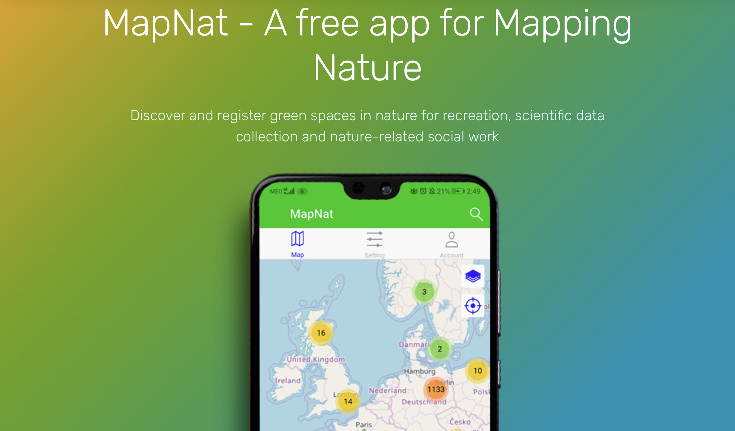
The MapNat mobile app aims to help citizens discover and register green spaces in nature for recreation, scientific data collection and nature-related social work.
Short summary of the practice
The MapNat mobile app aims to help citizens discover and register green spaces in nature for recreation, scientific data collection and nature-related social work.
Goal of the practice
Mapping green spaces.
Target group
Young and adult active citizens, people who enjoy sports and walks in nature.
Number of participants: Unlimited
Age of participants: Youth and Adults, 12+
Materials
- Phone
- Internet access
- Camera
Method settings
The method can be adapted to any city and done online.
Duration
Time needed to find and share new green spaces.

Preparation
1-2 hours
Step by step guide
Participants must install the free MapNat mobile app and fill in the questionnaire while mapping areas in nature. The app focuses on three use cases: for recreation (by citizens for citizens), for science (with targeted guided questionnaires by researchers for a specific group/location) and for activism that brings about social change. These frameworks are similar in application, just need different preparation times and marketing strategies.
Expected output
The output is a map that creates an overview of the state of nature resources: is there any issue to be reported, or an action to be taken, or maybe an improvement to be suggested?
DOs, DONTs and ethical considerations of the method
DOs :
- Add new space for helping others.
- Refresh/change information if the place become urban.
DONTs :
- Avoid sharing false information.
Change the method brings to the communities
MapNat allows users to find a green spot to relax and enjoy the day, not only to share with citizens their favourite green places in the city, but also to support environmental research and promote better environmental policies and activism.
Adaptation/Application of the method
Researchers can use the app to manage data collected through observation, face-to-face interviews or by using this app. It can improve scientific knowledge of urban green spaces and their use by citizens, which can help to generate outputs that can be used to improve the well-being of society.
The app allows users to collect relevant observations in the field and translate this environmental knowledge into concrete actions, so that MapNat can help implement environmental projects that bring social improvement and empowerment.
Credit, References, and Resources
The link to the app – https://mapnat.org/
Photo sources: https://mapnat.org/, date: 20.11.2023
Related posts

Active Citizenship
Active citizenship in this context refers to the power of individuals or small resident groups to proactively engage in community mapping exercises for improving their city or neighborhood.

ArcGIS Online
ArcGIS Online provides a cloud-based mapping and analysis solution. It is used to create interactive web maps, analyse data, share and collaborate.

Civic Alert
Civic Alert is a platform designed to facilitate communication between citizens and governments. Citizens can use their mobile application to report problems in the city to the authorities in three easy steps.
