Linguistic Landscaping
EXPLORATION & KNOWLEDGE SHARING
The Linguistic Landscaping method analyses the use and representation of languages on public and commercial signs, revealing the visible and hidden meanings within a given area or territory.
Short summary of the practice
The analysis of the findings of the method helps to understand language use, coexistence, alternation and transitions to multilingual environments. The method can also reveal power dynamics and societal changes, as it can indicate the emergence or decline of particular languages in public settings, thereby revealing broader sociolinguistic shifts. The linguistic landscape is in essence a reflection of societal language habits and beliefs, and its study can shed light on the intricate complexities of multilingual communities.
Goal of the practice
The Linguistic Landscape method analyses the use and representation of languages on public and commercial signs, revealing the visible and hidden meanings within a given area or territory.
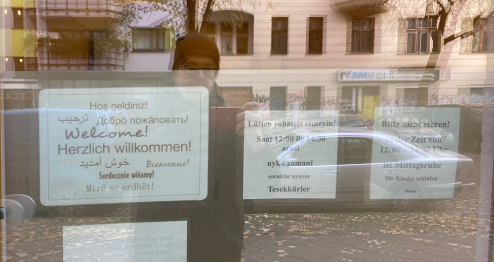
The process involves examining the representations of languages in public settings, such as banners, store and restaurant names, road signs, names of streets, shop windows, graphity, stickers, billboards etc. The focus is on written language that everyone can see and read. The method involves interpreting the representation of languages together and discussing what it might say about the area and the people who live there. Linguistic landscape mapping also analyses hidden meanings and messages hidden in language and how they can impact individuals and communities. Furthermore, the method involves the analysis of how languages on these public signs are represented. For example, whether they are monolingual or multilingual, their content, the medium of the signs, and the domains in which they occur.
Target group
Young people, adults, children with some modifications. Participants should be able to read.
Number of participants: 6 – 20 persons
Age of participants: From 12 years old
Materials
- Mobile phones at least one per group of participants
- Portable Bluetooth printer or access to a colour printer (may take longer to print everything from a mobile phone) or Polaroid camera
- White board/flip-charts for present results
- A0 white paper sheet or white board paper roll
- Colour Markers to draw on the paper
- Something to attach printed photos with (e.g. double-sided adhesive tape)
- Computer with projector to present a method to the group
Method Settings
A room big enough to fit all participants and form groups for discussion and presentations with tables and chairs. The main activity is carried out outside in the chosen area/street of the city.
Duration
120 – 150 min depending on the group size and the area

Preparation
The most important is to choose or identify the area for the linguistic landscape. The area can be one or two streets that the group can cover in 20 minutes of slow walking. The facilitator may need to prepare some slides to explain the method to the group. It may be useful to gather some information about the history of the place to share with the participants. This can help to discuss the dynamics of the city over time, based on the evidence the group has collected.
Step by step guide
- Present the method to the group and possibly some historical facts about the place, the building(s) or the events that took place there.
- Divide the participants into groups of 3 to 7 people. Try not to have more than 3 groups.
- Each group should pick a side of the road or a direction to follow in the area.
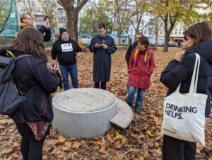
- Ask participants to take pictures of any language signs that represent the cultural and linguistic diversity of the area. Participants can interact with locals and find out about the area, places they like or dislike, the community, collect stories. Allow approx. 30 minutes for the group discovery walk.
- Once the groups have arrived at the agreed meeting point, participants can begin to discuss their impressions from the walk, and together select and print 10 photos that they feel are representative of the area. Allow approx. 30 minutes for this activity.
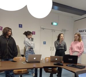
- Participants attach the photos to the printed or schematic map of the area and explain their choices to the rest of the group.
- The facilitator works with participants to find common ground for describing the area, giving everyone a chance to express an opinion. Summarise the participants’ findings and observations in short sentences and write them on the paper representing the area. Based on the results, close the session and take the photo of the final result.
Expected output
Linguistic landscape research examines the relationship between written languages in public spaces and the socio-demographic structure of a place/street/area.
At the end, a map will be produced with 20 – 30 photos and a summary of the description of the area based on observations and interviews with locals.
DOs, DONTs and ethical considerations of the method
DOs of the method:
– Pay attention to every written sign and try to capture a variety of signs.
– Visual language is also a language, so it can also be used to create a linguistic portrait of the area.
– Ask people for permission to take pictures of their shop, pub, etc.
DONTs of the method:
– Do not take photos that contain private information (e.g. surnames on doorbells).
– Do not take photos of people or private things unless you have permission.
– Do not photograph children or private property
Change the method brings to the communities
Potentially, this method can be used for a more profound understanding of areas in the city to make decisions on how the place should look and change. Another possible use of the method is a dynamic change of the community if such an analysis is done at regular intervals. It can be a good tool to observe whether the changes/modernisations that have been implemented have had an impact on the local community. Can also be used as a tool to identify different groups of citizens that should be included in a participation process for development.
Adaptation/Application of the method
The method is mostly used for research purposes, and in some cases researchers actively invite people to participate in this research. For example, here is the application of the University of Luxembourg, which is actively using the method – lingscape.
Potentially, this method can be used for a more profound understanding of areas in the city to make decisions on how the place should look and change.
Another possible use of the method is a dynamic change of the community if such an analysis is done at regular intervals. It can be a good tool to observe whether the changes/modernisations that have been implemented have had an impact on the local community.
Credit, References, and Resources
First publication about the method – https://www.researchgate.net/publication/247744019
One of the latest theoretical reviews of the method – Rahmat Gaho*, I Nyoman Kardana, Rika Purnama Sari, (2022), “Linguistic Landscape (LL): A Theoretical Review” in The 1st International Student Conference on Linguistics: Trends and Future Perspectives in Linguistics Study, KnE Social Sciences, pages 215–221. DOI: http://dx.doi.org/10.18502/kss.v7i10.11290
The case study description – https://www.langwork.eu/post/linguistic-landscape-mapping-get-to-know-your-neighbourhood
lingscape app from University of Luxemburg (Université du Luxembourg Institut fir lëtzebuergesch Sprooch- a Literaturwëssenschaft) – https://lingscape.uni.lu
Related posts

Active Citizenship
Active citizenship in this context refers to the power of individuals or small resident groups to proactively engage in community mapping exercises for improving their city or neighborhood.

ArcGIS Online
ArcGIS Online provides a cloud-based mapping and analysis solution. It is used to create interactive web maps, analyse data, share and collaborate.

Civic Alert
Civic Alert is a platform designed to facilitate communication between citizens and governments. Citizens can use their mobile application to report problems in the city to the authorities in three easy steps.
