Kinder Kiez Karten
EXPLORATION & KNOWLEDGE SHARING
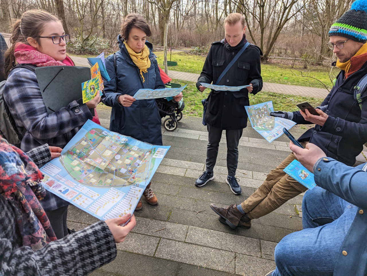
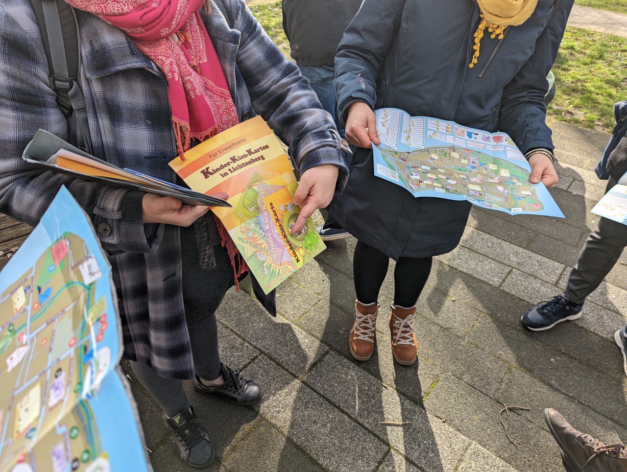
Kinder Kiez Karten is a method to create local neighborhood maps by children for children.
Short summary of the practice
Kinder Kiez Karten is a method that was developed and implemented by the Youth Participation Department of the municipality of Lichtenberg (a district in Berlin).
Goal of the practice
The aim was to create local neighborhood maps by children for children.
Target group
School children
Number of participants: minimum 12 participants per map
Age of participants: youth aged 8-16
Materials
Manual
Pens
Sheets
Method settings
The method can be adapted to any city.
Duration
5 days


Preparation
Some preparation is needed.
For example, the facilitator may need to do some research on the area to define the part that will later be taken for the children to explore. They will need to find/create and print a map of the area. Then a plan for a series of activities is needed to design with the children the stickers/drawings that would be added to the map, representing different places in the neighbourhood and emotions associated with the place. An additional workshop on map reading and mapping should be added to the activities.
Step by step guide
The method takes 5 days to create a map with a group of 12 children. The method comes with a detailed step-by-step manual that includes a planning work frame and resource budgeting. The manual covers all costs from lunch packages, pens and papers, to the number of facilitators per group of children and the recommended and estimated timeframe to go out for the mapping action. What makes this manual special: it includes a hands-on protocol for facilitators written by the educators and also a manual for the children, written by the children.
Expected output
The map created by the children gives important insights about areas that they value and areas that need to be action upon. The drawings by children can provide information about their fears in the neighborhoods, no-go areas, or unattractive places that are not that obvious for adults. Children tend to highlight the very pleasant areas where they like to spend time and simplify the city infrastructure according to their needs.
DOs, DONTs and ethical considerations of the method
DOs:
- Do help children if there are difficulties
Change the method brings to the communities
FOR CHILDREN
The Maps have been designed by children for children and represent a view through their eyes. This gives them a strong sense of identification with the neighbourhood in which they live, they learn to use the maps to orient themselves in social space, and they help to bring other children closer to the neighbourhood. They also learn to read maps and become aware of mapping.
FOR ADULTS
Not only do children show each other their neighbourhoods, they also show adults from different areas their living environment. People from administration, politics, or the police use the maps to find out what is not so nice in the neighbourhood and what could be done better. A view of the neighbourhood through the eyes of children can also be useful for multipliers, i.e. educators, teachers and pedagogical staff as well as parents. The children’s neighbourhood maps can be used to explore one’s own neighbourhood, but also other neighbourhoods, in a new way.
Adaptation/Application of the method
The participation in a democratic process and in co-creation of a map for children at a young age is definitely empowerment for the young generations. Additionally, the families and neighbours that get in contact with the map created by their children will start rethinking about their surroundings and create a feeling of connection with the public space where they spend time at.
Credit, References, and Resources
Link to the maps and to the description of the project – https://www.kjb-lichtenberg.de/kinderkiezkarte
Related posts

Active Citizenship
Active citizenship in this context refers to the power of individuals or small resident groups to proactively engage in community mapping exercises for improving their city or neighborhood.

ArcGIS Online
ArcGIS Online provides a cloud-based mapping and analysis solution. It is used to create interactive web maps, analyse data, share and collaborate.

Civic Alert
Civic Alert is a platform designed to facilitate communication between citizens and governments. Citizens can use their mobile application to report problems in the city to the authorities in three easy steps.
