Green Kalasatama
DIALOGUE & INTERACTION
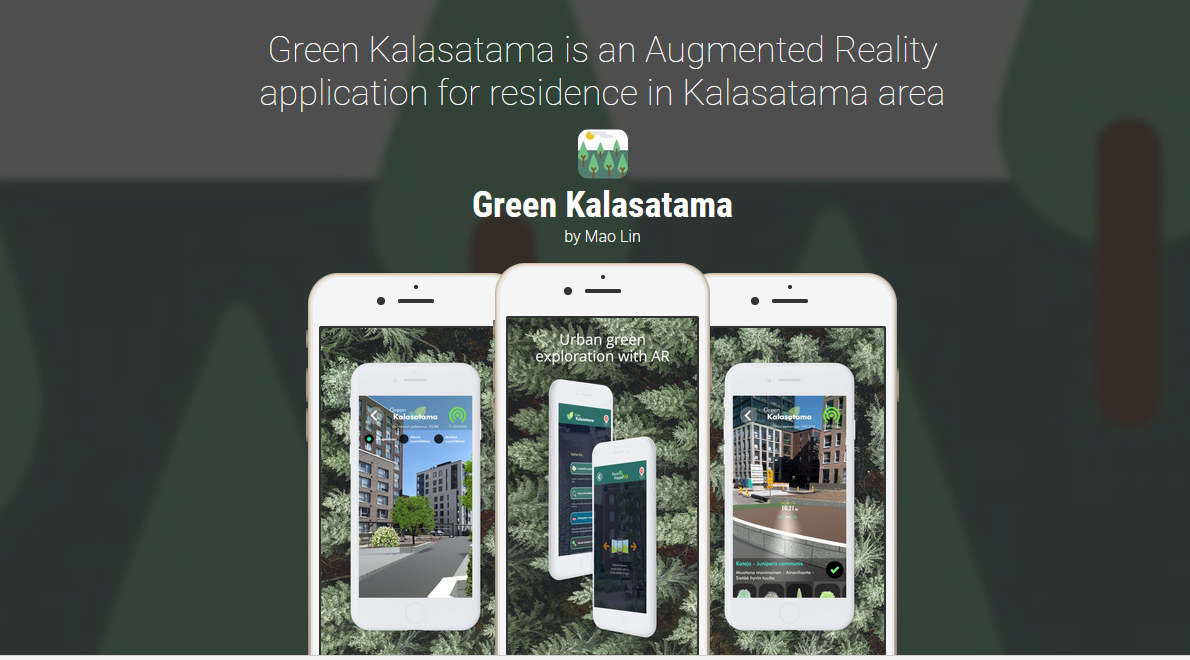
Green Kalasatama is an Augmented Reality (AR) application for residents in Helsinki’s Kalasatama area that enables residents to use their mobile devices to map local plants.
Short summary of the practice
Green Kalasatama, developed by Granlund Oy, is an innovative app featuring various AR tools, specifically designed for the inhabitants of Helsinki’s Kalasatama district. It enables users to visualize future neighbourhood projects, collaborate in park designs, and document local plant life using advanced augmented reality technology, with the overarching goal of enhancing community engagement in urban development processes. The specific mapping component of Green Kalasatama is its PlantLIFE Mapper AR feature, which empowers residents to identify and map local plant species on an online map of the neighbourhood. The map offers a dynamic view of the area’s flora.
Goal of the practice
The Green Kalasatama app enhances resident participation in urban planning. Its PlantLIFE Mapper AR feature ties into urban ecology development, allowing the city to gather precise data on plant species and their locations—even from privately maintained areas like courtyards. Additionally, participants and those viewing the map can deepen their knowledge of local flora and better appreciate the green spaces around them.
Target group
All citizens
Number of participants: Unlimited
Age of participants: Adults and Youth, 12+
Materials
Participants are required to have:
- Smartphone with a camera
- Internet access
Method settings
The tool was developed in Finland and is mainly used in Finland.
Duration
Ongoing once set up.

Preparation
Mapping project initiators require substantial preparation for setting up the localized AR environment. Mapping participants don’t require much preparation other than reading the instructions of the app.
Step by step guide
The Green Kalasatama app, including its PlantLIFE Mapper AR feature, was launched in response to the B.Green project’s pilot call to advance Smart City development in Helsinki. For now, its use is confined to the Sompasaari region of the Kalasatama district; deploying it in other areas would necessitate additional programming.
To use the mapping function, participants should first install the Green Kalasatama app on their mobile devices and access its plant mapping section. They then aim their camera at the desired plant (e.g., a tree) and outline a geo-tagged region around it within the app. After identifying the plant type, the data is uploaded to the cloud, making it accessible to all app users.
Expected output
The primary objective of the Green Kalasatama’s PlantLIFE Mapper AR feature is to engage residents in recording and observing their local flora. This provides data for Helsinki’s city planners. Additionally, as residents interact with the mapping, they gain insights into their local plant life.
DOs, DONTs and ethical considerations of the method
DOs of the method:
- Do use the application for personal projects
DONTs of the method:
- Avoid the use of the app for malicious purposes
Change the method brings to the communities
Allows citizens to visualize future parks and green areas.
Adaptation/Application of the method
The Green Kalasatama app provides a new technological way for residents to participate in the development of their neighbourhood. It is, however, unclear how their contributions are or will be addressed in city planning.
Credit, References, and Resources
Link to the tool – https://fiksukaupunki.fi/en/projects/green-kalasatama/
Photo sources: https://fiksukaupunki.fi/en/projects/green-kalasatama/, date: 20.11.2023
Related posts

Active Citizenship
Active citizenship in this context refers to the power of individuals or small resident groups to proactively engage in community mapping exercises for improving their city or neighborhood.

ArcGIS Online
ArcGIS Online provides a cloud-based mapping and analysis solution. It is used to create interactive web maps, analyse data, share and collaborate.

Civic Alert
Civic Alert is a platform designed to facilitate communication between citizens and governments. Citizens can use their mobile application to report problems in the city to the authorities in three easy steps.
