

Active Citizenship
Active citizenship in this context refers to the power of individuals or small resident groups to proactively engage in community mapping exercises for improving their city or neighborhood.
ArcGIS Online
ArcGIS Online provides a cloud-based mapping and analysis solution. It is used to create interactive web maps, analyse data, share and collaborate.
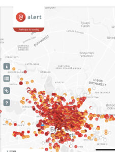
Civic Alert
Civic Alert is a platform designed to facilitate communication between citizens and governments. Citizens can use their mobile application to report problems in the city to the authorities in three easy steps.

CIVIC LABS – Civic technology solution generator
Civic Labs is a set of practices to ensure citizen access and transparency to public data, and to provide citizens with digital tools to help them make the best decisions to improve the lives of communities.

Community of personal needs
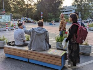
The method can be used in various contexts involving groups of people who want to design a common space or project together, such as gardens, public spaces or urban planning scenarios.
Crowdsorsa
Crowdsorsa is a photo app to crowdsource data collection, that cities can use to nudge citizens to map their surroundings by taking geo-tagged photos.
Ecomuseo Casilino
The concept of Ecomuseum emphasises the link between the museum and its social and environmental context. Ecomuseums encourage sustainable community development through local organisations that promote the conservation of heritage related to a geographical area.

Green Kalasatama
Green Kalasatama is an Augmented Reality (AR) application for residents in Helsinki’s Kalasatama area that enables residents to use their mobile devices to map local plants.

Hoodmaps
Hoodmaps is a crowdsourced map to navigate cities based on tags such as: hipsters, tourists, rich, normies, suits and uni areas.
Hush City App
The Hush City is a free mobile app that enables people to find and rate quiet places in cities. It has an open-access, web-based map of quiet places that has the potential to guide policies and guidelines for healthier living for citizens.

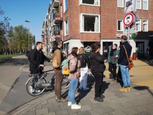
Instawalks
An Instawalk is an exploratory walk that allows participants to experience a particular part of a city or landscape. People post their pictures on social media immediately after taking them, often on Instagram.
KiezActionBound
KiezActionBound helps to discover a neighbourhood with gamification. It’s based on the Actionbound app, a tool for creating educational games such as digital treasure hunts, mobile adventures, and interactive guides.
Kinder Kiez Karten
Kinder Kiez Karten is a method to create local neighborhood maps by children for children.
Kulturtester
Culture Tester is a method from Experience Design. It is based on the assumption that places and spaces create their own culture and is based on giving users an understanding of how they experience a space by producing cultural value and meaning for it.

Linguistic Landscaping
The Linguistic Landscaping method analyses the use and representation of languages on public and commercial signs, revealing the visible and hidden meanings within a given area or territory.
Living lab Vrederust
This program can be used to showcase the area’s potential future to all stakeholders and invite them to dream.

Map your flat
“Map Your Flat” is an online adaptation of the “Map Me Happy” approach, designed to help participants reflect on their senses and map areas within their apartments where they experience positive sensations.
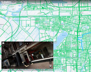
Mapillary
Mapillary is the platform that provides street-level images and map data for the purpose of scaling and automating mapping.

MapNat
MapNat is a free app for mapping nature. It enables citizens to discover and register green spaces in nature for recreation, scientific data collection and nature-related social work.

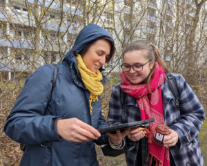
Maptionnaire
Maptionnaire is a map-based survey tool tailored to infuse community feedback into modern planning systems.
Mundraub.org
Mundraub.org is the biggest German-language platform for finding and sharing edible landscapes.
Nostalgeo
NOSTALGEO allows people to view old photos combined with today’s Street View. Users can also add and manage their own photos for free using the upload module.

Participology
Board game practice that allows participants to take on different roles and facilitates decision-making in urban planning.
Seismic Alert
This platform collects information from citizens and volunteers about earthquake.
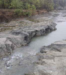
Spotting flooding areas around the home
This practice is intended for residents of flood risk areas. The method involves the use of basic geographical knowledge to locate the river and the riparian areas with potential exposure to overflowing waters.

Storymaps
Storymaps (ArcGIS StoryMaps) is a web-based storytelling tool that allows users to display their maps alongside text and other multimedia content.
URBANAGE IoT devices
URBANAGE stands for Enhanced URBAN planning for AGE-friendly cities through disruptive technologies. The tool facilitates easy digital data collection from older residents.